SIMULATION
AND VULNERABILITY ANALYSIS OF TSUNAMIS AFFECTING THE ISTANBUL
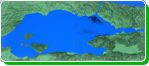
COASTS
Istanbul Metropolitan
Municipality, Directorate of Earthquake and Ground Investigation
has initiated a complete project on micro zonation of Istanbul
City. The project Simulation and Vulnerability Analysis
of Tsunamis Affecting the Istanbul Coasts is one of the
branches of İstanbul Micro zonation Project. The tsunami
studies aim to produce the Tsunami Hazard Map in order to
assess tsunami risk and its impacts on Istanbul Metropolitan
Municipality, to disseminate the possibility of a Tsunami
Warning System, and to perform the necessary analyses for
proper land use and development of strategies for mitigation
of the possible effects of tsunami on Istanbul coasts.
The data collection,
compilation, analysis and evaluations have been performed
by Oyo International Co. (OIC). Comprehensive tsunami simulations
were based on 49 different scenarios considering not only
active faults but also submarine landslide induced tsunamis
by using OIC, a widely accepted, scientifically verified
tsunami simulation code TUNAMI N2. The animations of the
selected scenarios have been prepared by METU, The Department
of Civil Engineering, Ocean Engineering Research Center
using the tsunami simulation and visualization code NAMI
DANCE, which has been developed for tsunami numerical modeling
and simulations by Profs..Nobuo Shuto and Fumihiko Imamura
in Tohoku University Japan. TUNAMI N2 determines the tsunami
source characteristics from earthquake rupture characteristics.
It computes all necessary parameters of tsunami behavior
in shallow water and in the inundation zone allowing for
a better understanding of the effect of tsunamis according
to bathymetric and topographical conditions.
NAMI DANCE has been
developed by Profs. Andrey Zaytsev, Ahmet Yalciner, Efim
Pelinovsky and Andrey Kurkin. As well as tsunami parameters,
NAMI DANCE computes the distributions of current velocities
and their directions at selected time intervals, relative
damage levels according to drag and impact forces, and it
also prepares 3D plots of sea state at selected time intervals
from different cameras and light positions, and animates
the tsunami propagation between source and target regions.
European Union Project
named Tsunami Risk and Strategies for European Region (TRANSFER)
funded by European Commission in FP6 Framework has partly
contributed this project.